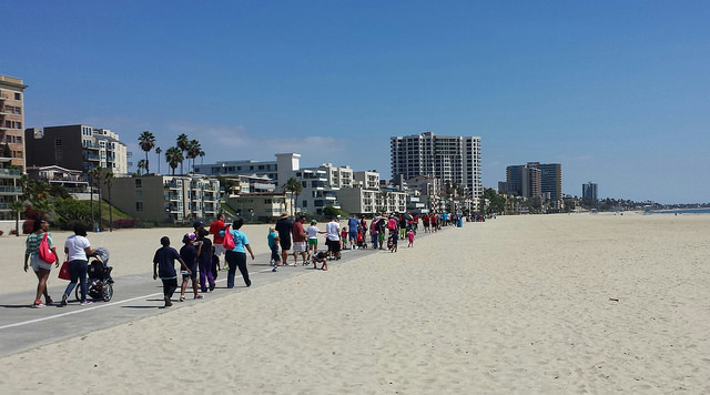
This year’s route for the Walk for Food Allergy was a lot longer than last year’s, when we walked out along a jetty and back. That was a comfortable 1½-mile round trip surrounded by ocean. This was 1½ miles each way on a path along the beach, surrounded by reflective white sand, in the hot sun, with no shade. (Hey, at least it wasn’t last weekend, when it hit 99°F.) In fact, since the signs ran out about halfway there, a lot of us started to wonder if maybe we’d missed the turnaround.
Some families turned around early. We almost did, but spotted a sign on a table full of water bottles not far ahead, and we decided to go at least as far as the water. We asked the woman staffing it where the turnaround point was, and she told us that was it.
Wait, Why Were You Walking?
 Every year, FARE sponsors events around the country to raise money for research and education, and to increase awareness of food allergies. 15 million people in the US alone have food allergies — and for a lot of us, it’s severe enough to be life-threatening. FARE sponsors research into treatments and prevention, provides educational resources, and advocates for allergy-friendly policies and laws.
You can still donate through December 31 if you want to help!
We’ve been walking in the Los Angeles event for four years now. Our first year was in Santa Monica. It moved to Long Beach in 2012. That year the planned route was blocked by construction and it took about ten minutes to walk. Last year was the jetty, and this year we walked from the western end of Marina Green Park, across from Rainbow Lagoon, along the beach to the Long Beach Art Museum.
Obstacles
The registration area always has tables for the event sponsors: food companies with allergy-friendly samples, pharmaceutical companies that make epinephrine injectors (since that’s basically the only reliable treatment for an anaphylactic reaction once it starts), and local medical and support groups.
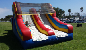 Lately they’ve also had a bouncy obstacle course and slide for the kids. Last year, J (almost three at the time) desperately wanted to go through it, and we wouldn’t let him because we thought the walk was about to start any minute. Then one person after another went up on stage to talk, and we realized he would have had plenty of time, but then the walk did start. We told him he could go on it when we got back…but we returned to see it being deflated.
This year, we made an effort to get there early, and we didn’t bother pulling him out until everyone had left the stage and they were calling us all to the starting line. He went through the course more times than I could count. We didn’t drag him away until they ran out of people onstage and told everyone to head for the starting line. (Of course this year they kept it inflated afterward, but we were too tired and hungry for it to matter.)
Wrapping it up
We finished up the afternoon with lunch at The Potholder Cafe Too, which reminded us of Broken Yolk Cafe in San Diego. They specialize in all-day breakfast — many, many varieties of all-day breakfast — but have sandwiches and burgers as well. I think I know where I’m going to grab dinner when I go to Long Beach Comic Con next weekend!