Flashback to April and Hawaii. On the day we drove to Kilauea we stopped at various places along the way. And since it’s a nearly-100-mile drive from Kailua, there was a lot to see.

We never made it down to South Point (the southernmost tip of the island), partly because of time and partly because—believe it or not—our car rental contract forbid us to drive on the 12-mile road out to the point! Supposedly it’s poorly maintained—or it used to be, and the policy hasn’t kept up—and they don’t want the wear and tear on cars that aren’t designed for it. As I recall, rental trucks and SUVs don’t have the restriction. This was the closest we ever came to it, and you can only barely see it way off in the distance.
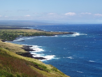
Coastline with coves and points

If you look at the end of the spray near the visible point, then go straight up toward the horizon, you’ll notice that the sky-sea line dips downward slightly and there’s a faint darker patch of sky. As far as we could tell, that’s the promontory heading out toward South Point. Even then, we weren’t quite sure. Update: It’s not. I checked the map when I finally uploaded these images to Flickr, and the highway doesn’t get close to the ocean on the west side. It’s a viewpoint near Haleokane, east of Naalehu and east of the turnoff to South Point Road. We’d already passed it!
Continue reading

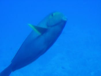
On the same day as our whale-watching cruise (April 6), we took a submarine tour of Kailua Bay from Atlantis Adventures. The tour started at the Kailua pier, where a boat ferried us out to the submarine in the middle of the bay. The sub itself went down to around 80-90 feet by the end of the trip, and we got to see all kinds of fish and coral.

Fish below Kailua bay

It didn’t look nearly so blue to us, of course, since our eyes were adjusted to it. Continue reading

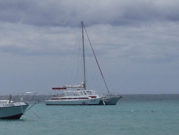
One of the first tours we signed up for on Hawaii was a whale watching tour. We figured even if we didn’t see any whales, we’d still have spent a couple of hours on a sailboat. It was April, near the end of the season, and we booked a tour through Red Sail (via Travelocity) on their catamaran, the Noa Noa:

View of catamaran, the Noa Noa

Continue reading

Kilauea is often called the world’s most active volcano. It’s been erupting continuously since 1983 at vents several miles away from the caldera. The eruptions are still inside Hawai‘i Volcanoes National Park, but the lava hasn’t stuck to the boundaries as it flows to the sea.

So late on an April afternoon, we started driving down Chain of Craters Road toward the ocean, hoping to see (from a safe distance) lava pouring into the ocean. The road is named because it connects a series of craters left behind by old vents. At first we stopped at all of them. They ranged from large craters like Keanakako‘i to fifty-foot-deep holes filled with rubble a dozen feet from the road. Soon we realized that would take way too much time, and stuck with the ones that looked particularly interesting.

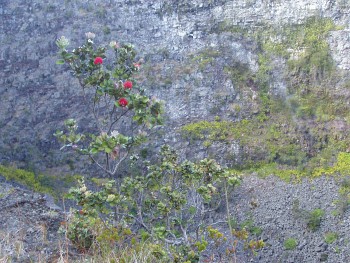
I don’t recall which crater this one was at (probably either Puhimau or Pauahi), but there was a trail up to a wooden viewing platform. I stopped at one point along the trail and took this picture of a small tree on the edge of the crater.

Tree on crater's edge

Continue reading

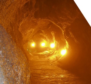
Let’s see, when we left off, we had nearly completed a circuit around the Kilauea caldera. Before driving down Chain of Craters road to the coast, we stopped at the Thurston Lava Tube. Update (2021): The park is now emphasizing the Hawaiian name for the cave, Nāhuku, but at the time we visited in 2005, all the labels we saw still called it Thurston Lava Tube.

Inside Thurston Lava Tube

Lava tubes are formed when smooth a’a lava flows through a channel, then crusts over. The still-molten lava underneath keeps flowing until the source stops, and it drains out, leaving a long tubelike cave.

We were lucky in that there were very few other tourists there at the time. (It was the first week of April, which isn’t exactly the height of Hawaii’s tourist season.) The Thurston tube is famous partly because of its size, and partly because it’s very easy to get to. It’s less than a quarter-mile walk from the road.

Continue reading

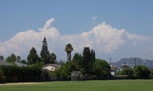
Well, June Gloom seems to be over, and we’re now into the time of year when we get hot, sunny days with lots of clouds. Big, towering cumulus clouds, often with anvil heads, promising shade and rain to cool things down. The teases.

Yeah, we see those clouds most afternoons—on the horizon, just on the other side of the coastal mountains!

While it’s great for summer activities—beach trips, swimming, hiking, etc.—it can also be frustrating when you have to choose between running your electricity-guzzling air conditioner all day or leaving your window open all night. The clouds are right there, taunting you with relief from the heat—relief that will not come.

Looking across a sports field covered in green grass, at a line of trees and houses, and a low cluster of fluffy cumulus clouds. Above, the sky is clear blue.

When I was in high school, my family took a vacation across the Great American SouthwestTM. We went to Bryce Canyon, Zion Canyon, and the Grand Canyon. We drove out to Mesa Verde, which wasn’t a canyon, but there were still a lot of cliffs. We came back through Arizona, where we stopped by Meteor Crater and Sunset Crater. We joked that it was a tour of all the big holes in the ground. (A few years later, I posted some photos from this trip online.)

The weird thing about it was that we went during August, and we got rained on at least briefly almost every afternoon—but only outside of California. Utah? Rain. Arizona? Rain. Colorado? Rain. I don’t think we got rained on during our three hours in Nevada (we stopped at Valley of Fire on the way out), but as I recall, the rain stopped about the time we crossed from Arizona back into California.

We don’t get summer storms much here in SoCal.

The Beat remarks that maybe Padres games during Comic-con WASN’T such a hot idea. [archive.org]

The Beat asked [the cab driver taking them to the airport] how traffic had been during the Comic-con/Padres game confluence.

“Oh, that was a fiasco,” she told us.

Having had to skip several trolleys that were indistinguishable from large moving sardine cans, I have to agree. On the other hand, the fireworks display over Petco Park on Saturday night was breathtaking!

Edit: The trolley system is working on untangling the mess for next time:

It was the first time the agency was called upon to overlay its special-event service, which runs between Qualcomm Stadium and the Gaslamp Quarter, with the new Green Line between Santee and Old Town.

Besides a steady stream of passengers at the San Diego Convention Center on what is traditionally the busiest day of the annual comics convention, trolleys carried 8,000 to 9,000 Padres fans. Some fans said they waited far longer than usual for the special-events trains, which normally provide speedier passage to and from the ballpark by bypassing downtown.

»All pages site-wide with this tag