The last time I went to Las Vegas was almost 20 years ago, after the last of the big themed resorts were finished and the city was moving onto more generic (but still glitzy) casinos and hotels. (We still have a pair of shot glasses from “Paris.”)

It’s bigger now.

We were only in town for one night last month, to catch a concert by a band that we’d missed when their tour stopped in LA. So we didn’t see much down on the ground, just the views from the taxis that went out to the freeway and back to avoid the traffic along Las Vegas Boulevard. It’s a sprawl of glass and steel now, and the main street was jammed solid.

I think my family drove through Las Vegas, sightseeing along the Strip, on one of our road trips back in the 80s or early 90s. Possibly the one where we stopped for a picnic at Valley of Fire. I wouldn’t try it today. (The picnic, sure, but not driving along the whole Strip. That way lies madness. And possibly road rage.)

There is one exception to the generic skyscrapers of the last couple of decades: The Hard Rock Hotel has taken over the former Mirage and is building a giant guitar-shaped tower in front. I took this photo from across the street, out in front of the Venetian. I hope they put the elevators on the outside where the strings would be.
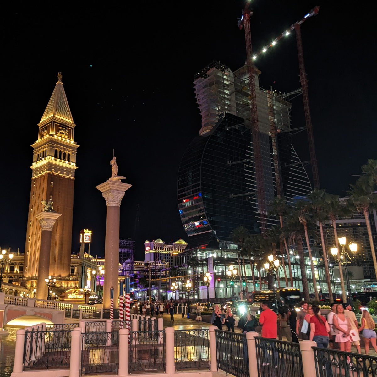
Night scene in Las Vegas. At the left, replicas of all the major landmarks of Venice are crammed into a small area. Off to the right, a tower is under construction in the shape of an upright guitar.

The Venetian Theater is beautiful inside, but either the acoustics are terrible or the sound designer for this show had no idea what they were doing. Or just didn’t care about those of us up in the (comparatively) cheap seats.
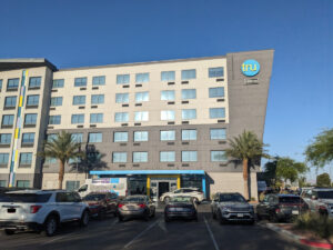
A six-level, no-frills building in two tones of beige (with a few blue-and-yellow highlights). About the only thing that stands out is a diagonal at one end that makes it look sort of like a Jawa sand crawler from Star Wars, if a sand crawler had more windows. An overhang shades a plain sliding-door entrance, and you can see two rows of parking spaces in front of it. We stayed waaaay off the Strip near the airport (though as it turns out, not as far as South Point) at a plain hotel (Tru by Hilton). No casino, not even a slot machine in the lobby. I was surprised, since the first time we stayed in town even the Holiday Inn (long since demolished) had a casino level. I guess they’ve found there’s a market for travelers who don’t want bells and clinking coins and flashing lights keeping them awake all night. (That’s what the air conditioner was for. Judging by the noise, it had been running continuously since the hotel opened a decade ago. Earplugs helped, even if the ones we picked up looked disturbingly like candy corn.)

High Desert

The desert between Barstow and Vegas, on the other hand, seems emptier. There are only two rest stops, one of which is currently closed for…well, the sign said remodeling, but I suspect they razed everything to the ground and started from scratch. Every so often you’ll pass an abandoned building covered in graffiti, slowly falling apart.

Primm looks OK at first glance as you drive past it, but then you notice how empty the parking lots are, and some of the signs that have fallen into disrepair. Reportedly the mall is down to a single store, and the last hotel/casino was set to shut down until it got a last-minute reprieve in the form of a partnership with Terrible’s. Today.

Even Baker is a shell of its former self (not that it was much to begin with). The giant thermometer is still there (for now), and the Mad Greek restaurant. Alien Fresh Jerky has actually expanded (though we didn’t stop there this time, for various reasons). There’s a new food court attached to a gas station at one end of town, and a Tesla supercharger at the other. The Bun Boy is long gone, along with all three motels. Empty lots and a few vacant buildings dot the frontage road.

Towers of Power

There’s a solar farm just on the California side of the border, visible from the freeway and from Primm. It has one field of photovoltaic panels and three thermal towers, the kind where a bunch of mirrors surrounding the tower track the sun and focus sunlight on a boiler to drive steam turbines and generate electricity.

White lines converge through the air from the ground to the top of a narrow tower in the desert. The top of the tower is overexposed white, even though the rest of the image is exposed properly.

Those things are bright! Seriously! Light beams from the mirrors converge visibly, and the tower reflects so much sunlight (despite using a bunch of thermal energy) it looks like an ultra-bright beacon. Photos can’t do it justice because, print or video display, they can’t shine enough light directly at your eyes to get the point across. This photo by Aioannides at Wikimedia Commons (CC-BY-SA) is better than anything we could get by pointing a camera out the car window from the freeway, and it still looks flat.

Brightline West is ready to start breaking ground this week, according to The Washington Post. The southwest endpoint will be in Rancho Cucamonga, where it will connect to Metrolink. (Which is definitely better than Victorville, which I’d seen suggested a few years ago.) Connecting to the existing lines here will make it simpler to build than trying to connect all the way to Los Angeles proper. (gift link)

Electric trains will depart every 45 minutes from a Las Vegas station south of the city’s storied Strip and a Southern California station in Rancho Cucamonga, a Los Angeles suburb about 40 miles east of downtown.

Traveling at up to 186 mph — faster than any other train in the United States — Brightline West trains will make the 218-mile trip in about 2 hours and 10 minutes.

Cross-posted from Metafilter

At first I thought this was a followup to another story about an anaphylactic reaction during an airplane flight last week. No, it’s a totally separate incident.

One patient had an expired epi-pen. The other had never had anaphylaxis before.

Both planes had bottles of epinephrine and a syringe, not an auto-injector. Fortunately there were doctors on both flights who knew how to figure out the dosage, properly fill and deliver a shot.

In the second incident, the patient who was experiencing anaphylaxis for the first time is a doctor, but…have you ever tried loading a syringe and injecting yourself while your throat’s rapidly closing up until you can’t breathe? There’s a reason they make auto-injectors!

It could be worse: the same site has an article about another in-flight reaction a month ago, where staff couldn’t get the emergency kit open for 10 minutes! This time it was a pair of nurses who measured and administered the shot.

This…seems to be more common than I thought it was.

And putting an emergency kit on the plane without training your flight crew how to use it is just ridiculous.

(Reminders to self: 1. Check epi-pen expiration date. 2. Make sure it’s easy to find in my carry-on next time I travel.)

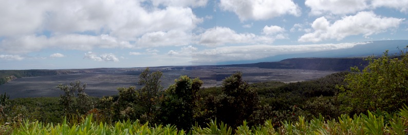
Back in 2005, we visited the Kilauea volcano in Hawaii. There were active lava flows at the time, but the main caldera was only venting gases (this was before the lava lake formed in Halema‘uma‘u).

We followed the road around the main caldera, then down to the coast to see where lava flows had obliterated the road and look at active flows waaaay off in the distance.

With the current eruption transforming the area, I’ve just uploaded an album to Flickr. You can look at the full-sized images there, or look back at my original blog posts in which I describe the trip.

Wide flat area with cliffs rising to the right, treetops in the foreground.

Expanded from a post at Photog.Social

At a tech training session, I wanted to get access to some of my class-related email on the training computer. But I didn’t want to log into my primary email on an open network, or on someone else’s computer at all. I have no idea what they’re logging, whether they’re doing SSL inspection, whether there’s a keylogger on it — probably not, but who knows?

Heck, I didn’t even want to use my own device on the hotel Wi-Fi without a VPN, and that was at least secured by WPA2! (then again…)

I ended up forwarding the extra class materials to a disposable email account and logging into that one. No risk to other accounts if it got sniffed, at any level.

But I remembered how we all used to get at email when traveling back in the early 2000s, before smartphones, and before every laptop and every Starbucks had Wi-Fi:

Internet Cafes.

We’d walk into a storefront and rent time on one of their computers. Then we’d go to our webmail site and type in our primary email login and password over plain, unsecured HTTP without TLS.

I’d never do that today. Admittedly, I wouldn’t need to in most cases — I can access my email wirelessly from a device I own that I carry in my pocket. (Whether that’s a good thing remains up for debate.)

But more importantly, we know how easy it is for someone to break into that sort of setup. Even if your own devices are clean, someone else’s computer might have malware or keyloggers or a bogus SSL cert authority on their browser to let them intercept HTTPS traffic. An HTTP website is wide open, no matter whose device you use. And an open network is easy to spoof.

So these days it’s defense in depth: If it needs a password, it had better be running on HTTPS. If I don’t trust the network, I use a VPN. And I really don’t want to enter my login info on somebody else’s device.

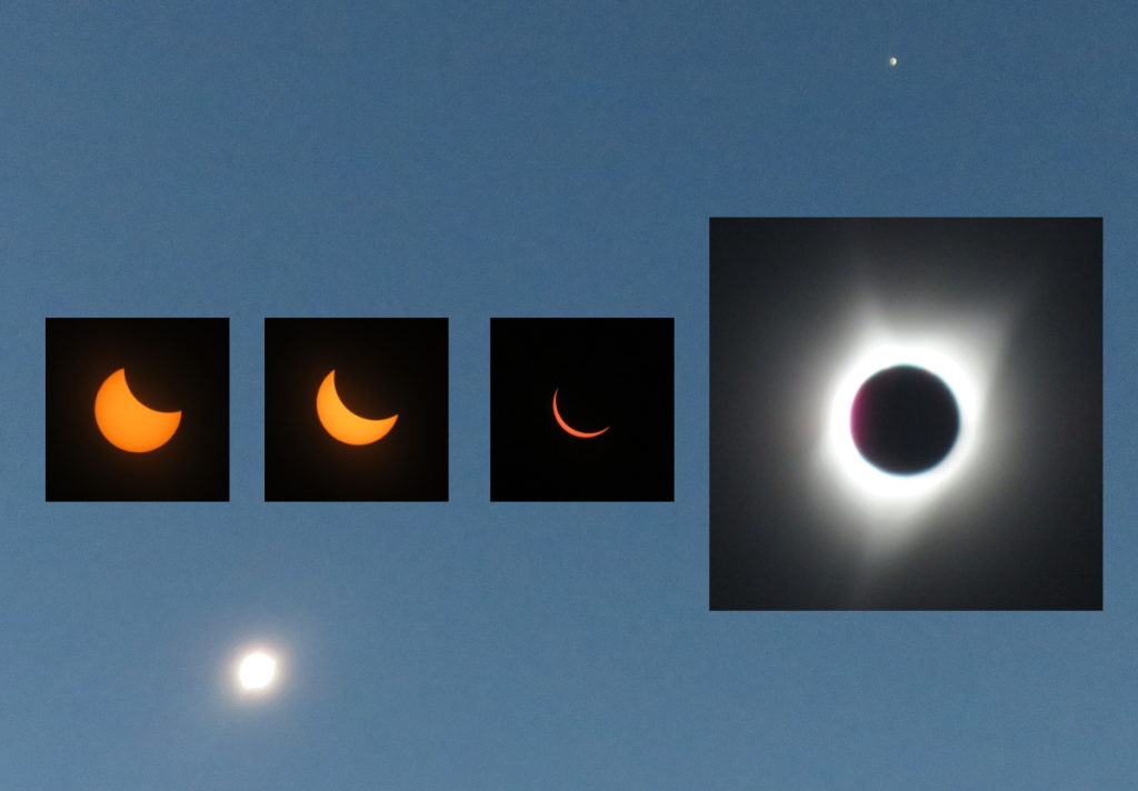
I’ve always wanted to see a total solar eclipse, but until now I never had the opportunity. I’ve caught a number of partial solar eclipses over the years, and quite a few lunar eclipses. This year’s “Great American Eclipse” was perfect: it passed close to Portland, where we have family, and we could visit friends on the way up.

By the time I reserved our hotel there was nothing left inside the path of totality, but we could still get an expensive room in Portland. I reserved that immediately for the nights before and after, then a motel for a few nights before so we would have time to visit, then we planned out the trip up and back.

Driving Into the Path

The morning of August 21, we got up at 5:30 to drive south into the path of the eclipse. We didn’t actually make it out the door until at least 6:30, and the parking attendant had lost our key (fortunately we had two, and they did eventually find it that afternoon), and then we got lost trying to find an ATM in case we had to pay a ton to park in someone’s field (one way streets and bridges and driving into the early morning sun), but we got on the road toward Salem by around 7:15/7:30, with our eclipse glasses, water, snacks/emergency food, and a very sleepy 6½ year old.

The threatened traffic jam carpocalypse didn’t materialize. There were slowdowns, sure, but nothing we hadn’t experienced on the way out of LA. Our nav system (which J. calls the “map lady”) sent us onto a side road at one point, and we drove through the countryside a while before getting back onto the interstate.

Continue reading

Anza-Borrego Wildflowers

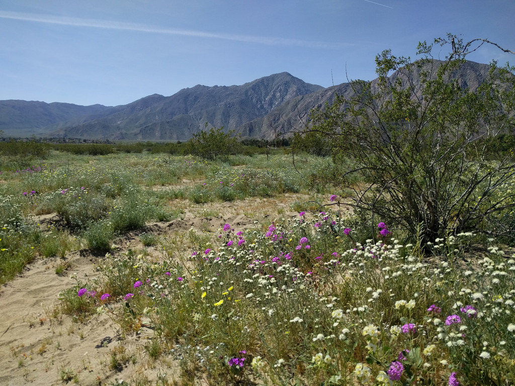
The kiddo had a day off from school in mid-March, so I took a vacation day and we all drove out to the desert to see the spring wildflowers. After the endless suburbia of Los Angeles, northern Orange County, and Corona, we drove past hills green from the winter rains, then into the similarly-endless suburbs of Temecula. It’s been years since I took Highway 79 south, and the city has grown a lot, but after a few miles the strip malls and housing developments disappeared, the road shrank to two lanes, and we drove through green hills with oaks, bushes, and the occasional patches of poppies, mustard and lupins. Fences, dirt roads and gates indicated ranches and wineries. Continue reading

»All pages site-wide with this tag