Between Google trying to bury its search under an “AI” chat and me moving most most of my website over to a new domain, I’ve been checking to see how well-indexed the old and new pages are at various search engines.

“Marineland of the Pacific” seemed to be a good phrase to test. Marginalia Search still has the old location for my Remembering Marineland (or not) post, but that search also turned up a page with scans of a Marineland ad flyer from 1962.

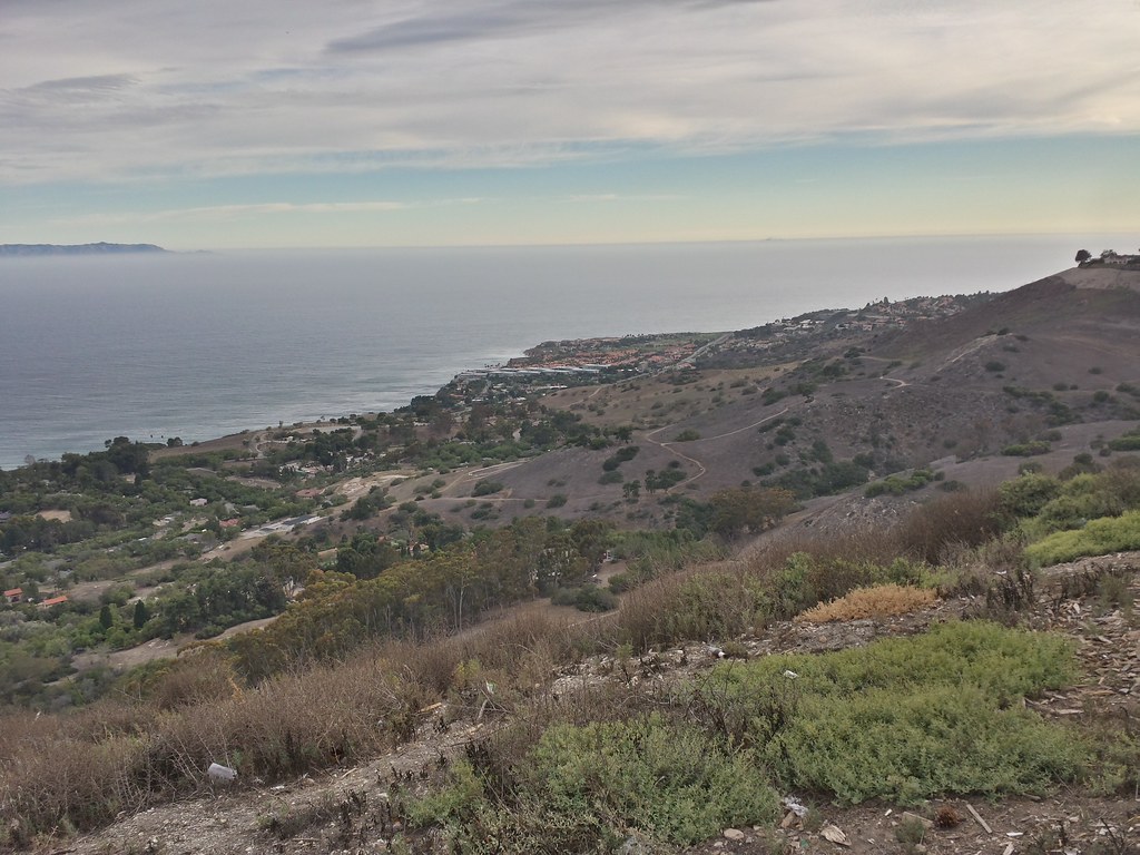
As someone who’s spent a lot more time hiking the Palos Verdes Peninsula than visiting an ocean theme park that closed when I was a child (not to mention way too much time updating OpenStreetMap), I was immediately drawn to the map…which strangely enough, shows Crenshaw Boulevard running over the hill, down through the Portuguese Bend landslide and connecting to Palos Verdes Drive South along the coast, just east of Wayfarer’s Chapel.

Simplified map of the Palos Verdes Peninsula showing Palos Verdes Drive around the peninsula, Marineland on one of the promonitories, major roads connecting to Los Angeles (Sepulveda, Hawthorne, Crenshaw, Western), and roads going *over* the hill including Hawthorne, Crest, and...wait, Crenshaw?

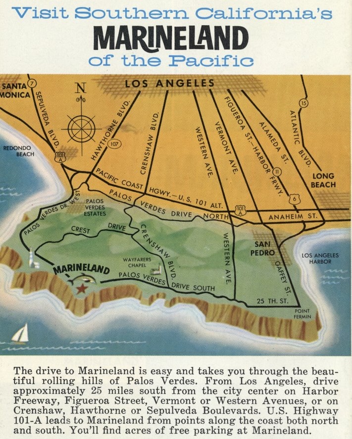
Wait, did Crenshaw actually connect sometime in the past? If so, how?

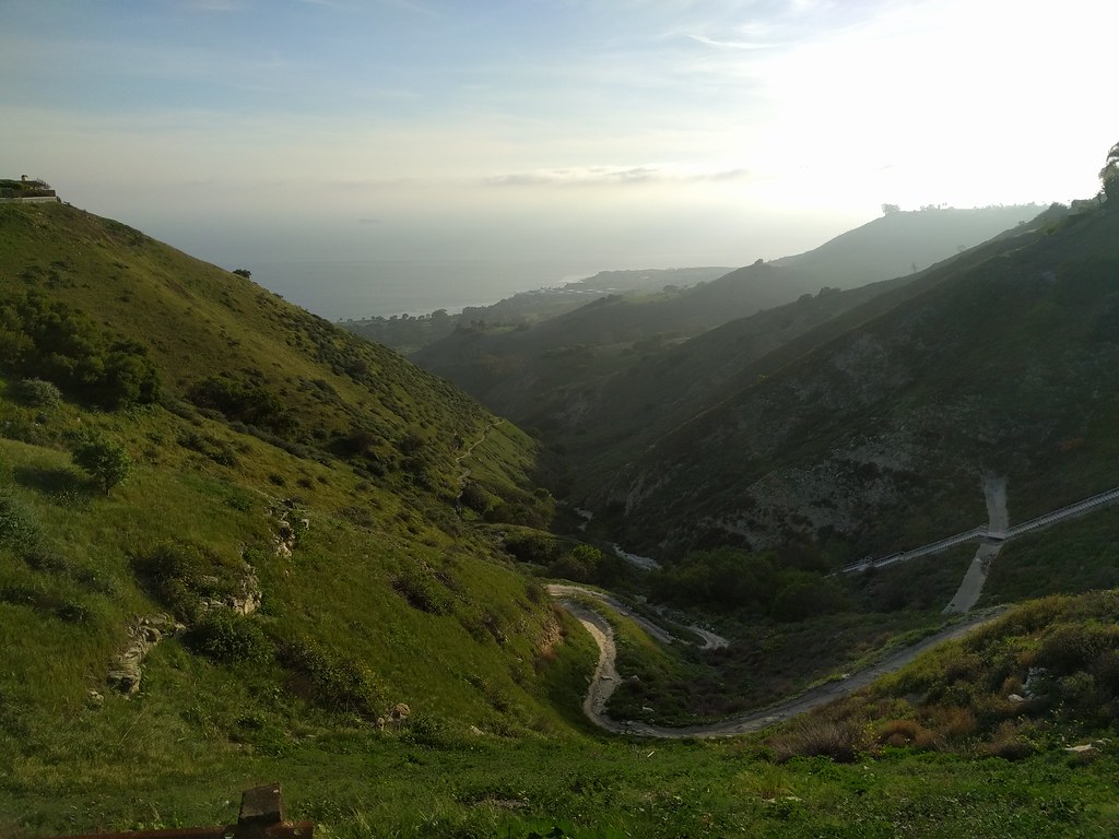
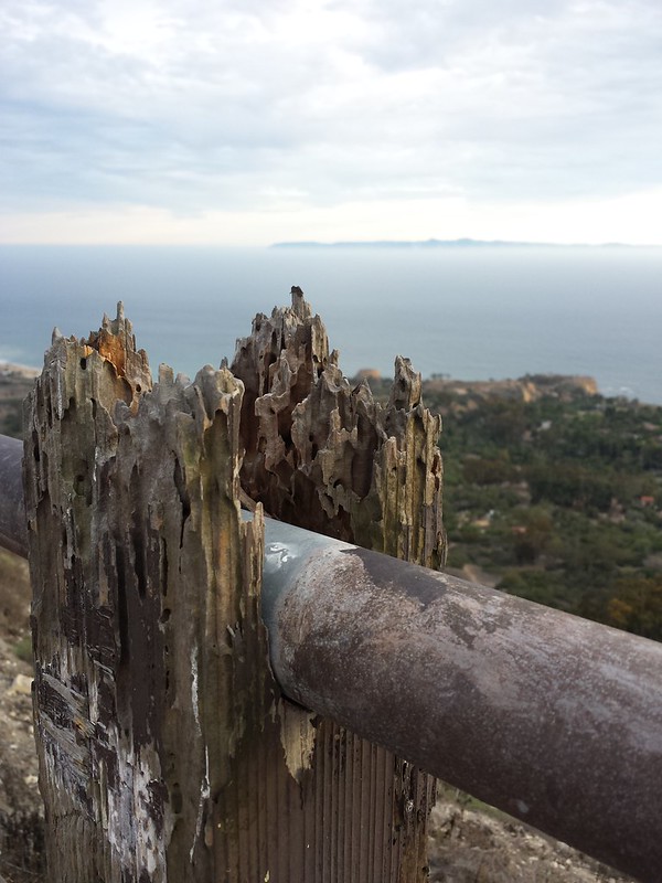
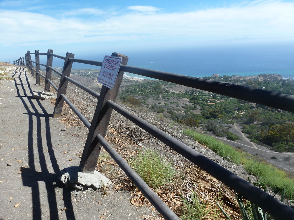
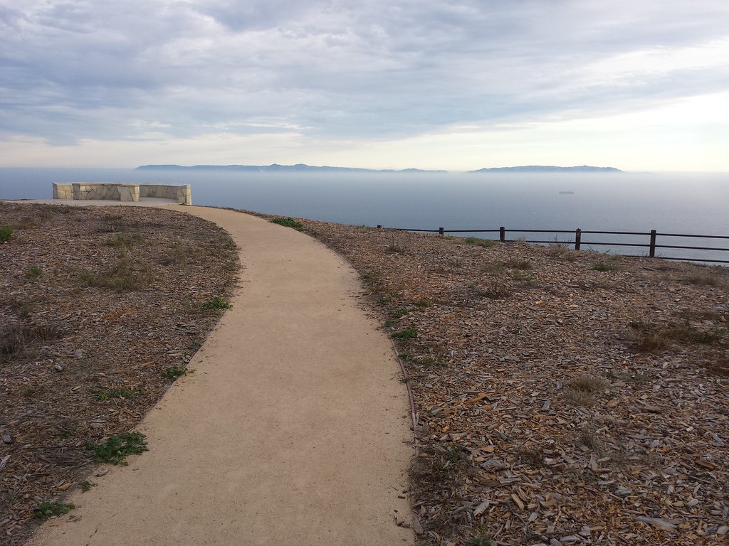
Today, Crenshaw runs up to the top of the hill and stops just past Crest Road, at Del Cerro Park. A dirt road continues past a locked gate, narrowing to a switchbacked path through the Portuguese Bend Nature Reserve. A landslide below it has been moving slowly for decades, preventing much in the way of construction on the land. Some people bought land and built houses on adjustable stilts so they could level the house every few months.

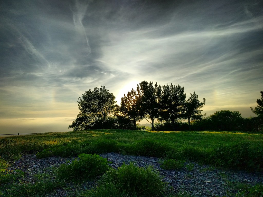
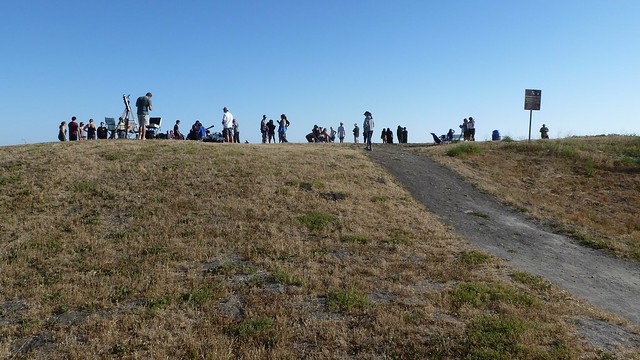
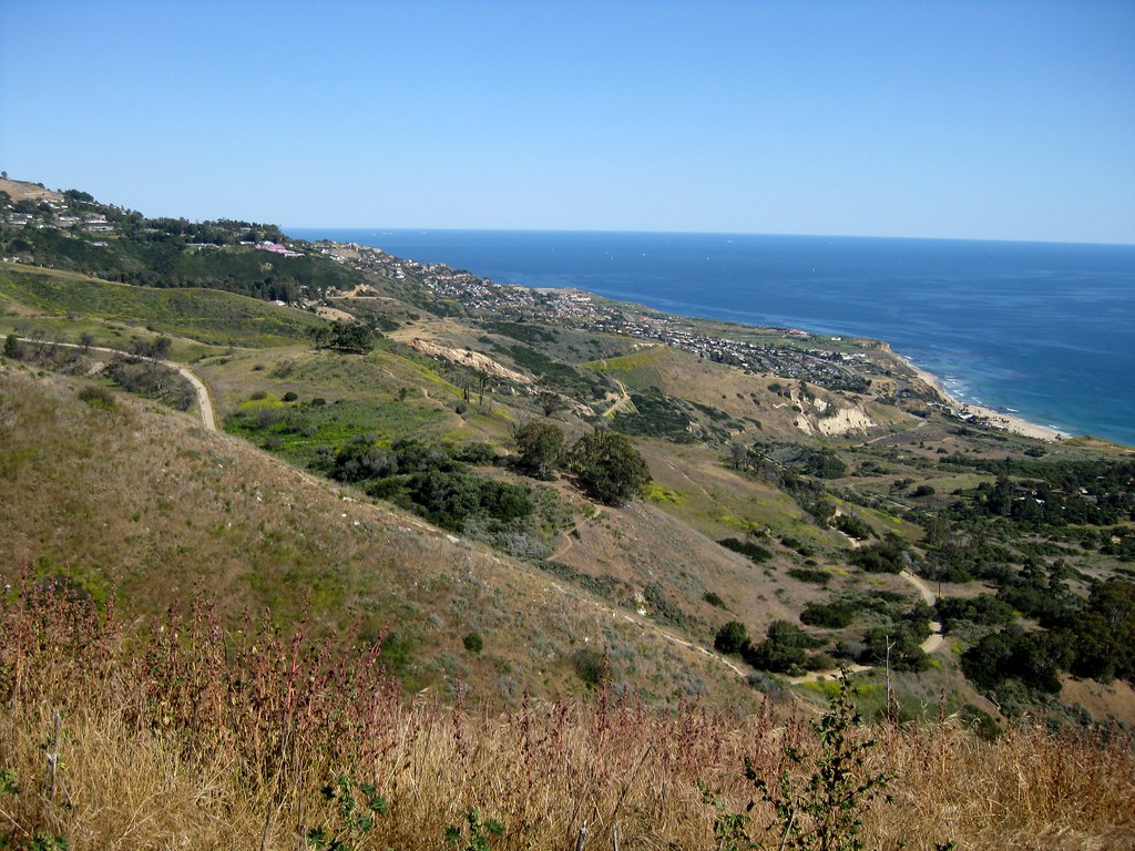
The first time I checked out the view from Del Cerro back in 2011, I took this photo of the area to the east, where Crenshaw appears on that map.

Looking out along a hillside sloping down to the ocean. Most of it is dry chaparral, with some clusters of darker trees, and a jumbled suburban neighborhood off in the distance as it levels out near the base. A dirt road snakes its way around the curves.

Over the last few years the land has been sliding faster, and a lot of the area has been closed for safety. Wayfarer’s Chapel has been dismantled to prevent it from flat out collapsing.

It’s no longer possible to connect Crenshaw to the coast.

But had it connected in the past, and been wiped out by the landslide? I went looking for the history, and found some articles that answered my question. I must have read this 2023 LA Times article when it was published, which means I’d forgotten a key detail about Crenshaw Boulevard’s relation to the landslide:

It caused it.

Crenshaw never connected to the coast. An extension was planned, and initial construction reactivated an ancient landslide in 1956, as crews moved enough dirt around to shift the underlying structure out of balance. At the time, the Portuguese Bend section hadn’t moved in roughly 4,800 years. In the 70 years since, it hasn’t really stopped.

If the map was drawn when the park was new, it would have been reasonable to assume that the road would be completed soon enough, and draw it in early. (“It’s finished on the map!”) But the scan shows a 1962 copyright date at the bottom. That’s six years into the landslide, more than enough time to realize the road was never going to be completed and paint over it for the latest printing. That makes me wonder why they hadn’t fixed it by then.

A whole lot of wispy clouds, plus fragments of a glowing circle above a green landscape. A grove of trees is silhouette against the sun.

After an afternoon of ice skating, I talked the family into making a quick trip up to Del Cerro Park in Palos Verdes. It takes a while to get there from home, but since we were already up in the hills for the ice rink, it was about five minutes. My original plan was just to walk out there myself, spend five minutes enjoying the view and taking pictures, then head back, but the five-year-old wanted to come along rather than wait in the car with mom.

Of course kids have their own pace, and while he wasn’t terribly interested in looking out at the ocean from a hilltop a few thousand feet up, he was fascinated by a lot of the other things along the way, which was how we ended up getting close to the hilltop at the right time for this view of the sky, sundogs, cirrus clouds, criss-crossing contrails, and silhouetted trees.

To be honest, he wasn’t terribly interested in that view either. At five, checking out foxtails and giant clover and gopher holes and fragments of concrete slabs (in a suspiciously flat and rectangular depression) and looking for the entrance to an incredibly long stairway and climbing and balancing on logs and looking for “the actual park part of the park” (i.e. the playground) are more appealing, and I barely had a chance for this moment to register.

Looking down a green valley toward a hazy coastline. A path winds along the bottom, disappearing behind shadowed hills long before it reaches the sea.

We did eventually make it up to the top of the hill and the viewpoint. The ocean was covered in haze, completely blocking the view of Catalina Island and any chance of watching the patterns made by ocean currents and waves far below. That was fine. It wasn’t the highlight for either of us.

Del Cerro Park sits atop a hillside overlooking the Pacific Ocean and, in the distance, Catalina Island off the coast of California. Suburbs surround it on the inland side, but the hills rolling down to the sea remain mostly open space (though to be fair that’s in part because the land isn’t stable enough to build on).

Normally I can put the car right in the lot when I go there. On the afternoon of January 1, I had to park all the way on the other side of the gorge that separates the outcropping from the rest of the neighborhood. I can’t complain, because I got to see this view on the way over…and on the way back, after sunset. Continue reading

Chaparral-covered hillside rolling down to a coastline, flat ocean and gloomy sky, blue visible in the distance.

Del Cerro Park, at the top of the Palos Verdes Peninsula, on a super windy evening. I saw two tumbleweeds roll by, and kept worrying I’d drop my phone while taking pictures.

I need to get out here (and other scenic spots) more often. Even though it’s not that far (one of the great things about the LA area is how close it is to sea, mountains, deserts, forests and so on), it’s so easy to get caught up in the day to day grind that you forget to step out and visit what’s right there, on the other side of the traffic and smog.

Dirt path curving away toward a hilltop with a bench. Only ocean and sky are visible beyond the hilltop

Photo album on Flickr: Del Cerro Views
Originally posted on Instagram

I had several plans for viewing today’s solar eclipse, depending on the weather. As the hour approached and clouds loomed in the west, I decided that my best bet would be to get above the cloud cover, and drove up into the hills to Del Cerro Park at the top of the Palos Verdes peninsula.

I’m glad I did, because a lot of other people had the same idea.

Individuals, couples, families, groups of friends, groups from schools — and everyone had a different way to see the eclipse: pinhole cameras, binoculars projecting on cardboard, welding helmets, “eclipse glasses” and more. There were also people who were just out for a day at the park, and wanted to know what was going on.

If J had been a few years older it would have been a family event for us too, but at a year and a half, I don’t think I would have been able to explain anything beyond “don’t look at the sun.” A partial eclipse is easy to miss if you’re not paying attention.

I’d cobbled together a pinhole camera the day before from two Amazon boxes, a sheet of paper, a sheet of aluminum foil, and lots and lots of packing tape. I actually started with just one box and I decided the image wasn’t big enough, so I grafted on a second. Even then it was only about 3/8″ across, but when testing it I could see the edges of clouds drifting across the sun, so I figured it would work. It did. Continue reading

It’s been six months since we moved, but I’ve only recently started really exploring the area. I think I just got caught up in too much other stuff for a while.

One day a few weeks ago, I tried to make it to the nearest beach I could in time for sunset. I missed…but while on the mostly-deserted beach I caught some nice views of pink underlit clouds over the Santa Monica Mountains, and this view of a closed lifeguard tower at El Segundo Beach.

Then there was the clear afternoon when I went exploring the Palos Verdes area, looking for public parks where I could see the LA basin. Not much luck on that count, but as sunset approached, I decided to see if I could make it up to Del Cerro Park (more photos from this spot taken during daylight) up at the top of the bluffs. I did, and because the park is actually higher than the next hill over, I got to watch the sun set over the ocean and behind a hill at the same time.

I stayed up there for a good 20 minutes after sunset, watching the sky darken through twilight. It was incredibly windy that evening, and even from a thousand feet up with no direct sunlight, I could still watch the waves between the mainland and Catalina Island, moving slowly through the strait like tiny ripples in the direction of the wind.

»All pages site-wide with this tag